Hôtel de ville
Auteur : Daniel Vorndran
Signaler

Quel est le profil de la population, sa situation démographique ?
| Nombre d'habitants | 62 443 | Classement |
| Age moyen | 39 ans | Classement |
| Pop active | 43.6% | Classement |
| Taux chômage | 14.9% | Classement |
| Pop densité | 4 803 h/km² | Classement |
| Revenu moyen | 18 260 €/an | Classement |


Quels sont les résultats des dernières élections aux présidentiels 2022 ?
 Emmanuel MACRON
 Jean-Luc MÉLENCHON
 Marine LE PEN
 Éric ZEMMOUR
 Valérie PÉCRESSE
 Yannick JADOT
 Nicolas DUPONT-AIGNAN
 Fabien ROUSSEL
 Jean LASSALLE
 Anne HIDALGO
 Philippe POUTOU
 Nathalie ARTHAUD
 Emmanuel MACRON
 Marine LE PEN
| Agressions physiques / sexuelles | 1 427 |
| Cambriolages | 151 |
| Vols / dégradations | 2 143 |
| Stupéfiants | 429 |
| Quartier | Habitants | Superficie | Pop densité | Pop active | Taux chômage | Revenu moyen | Note globale |
|---|---|---|---|---|---|---|---|
Cathédrale |
9 942 | 1.21 km² | 8 217 h/km² | 44.8% | 9.9% | 14 909 €/an | 4.0 |
Charmilles |
5 876 | 1.14 km² | 5 154 h/km² | 43.1% | 9.1% | 14 775 €/an | 1.2 |
Chartreux |
8 275 | 1.35 km² | 6 130 h/km² | 36.3% | 12.3% | 14 023 €/an | 3.6 |
Ecrevolles |
2 674 | 1.32 km² | 2 026 h/km² | 40.1% | 8.7% | 8 015 €/an | 1.4 |
Gare |
2 642 | 0.46 km² | 5 743 h/km² | 45.1% | 8.8% | 18 320 €/an | 3.8 |
Jules Guesde |
5 363 | 0.79 km² | 6 789 h/km² | 41.1% | 9.6% | 17 325 €/an | - |
Marots |
4 894 | 0.78 km² | 6 274 h/km² | 40.6% | 10.2% | 14 415 €/an | 3.2 |
Saint-Martin |
9 476 | 1.88 km² | 5 040 h/km² | 48.7% | 8.5% | 19 005 €/an | 4.2 |
Sénardes-Moline |
4 558 | 1.48 km² | 3 080 h/km² | 40.5% | 10.2% | 14 265 €/an | 1.9 |
Trévois-Croncels |
5 155 | 1.62 km² | 3 182 h/km² | 43.6% | 10.2% | 17 520 €/an | 3.0 |
Vassaules - Tauxelles |
3 742 | 1.26 km² | 2 970 h/km² | 47.7% | 11.7% | 16 470 €/an | 2.8 |
Commerce |
|
|---|---|
|
Hypermarché Saint-Julien-les-Villas 2km |
|
| Supermarché | 19 |
| Superêtte | 63 |
| Boulangerie | 28 |
| Boucherie | 23 |
| Restaurant | 138 |
| Garage | 62 |
| Station-service | 5 |
| Banque | 32 |
| La poste | 551 |
| Coiffeur | 138 |
| Tabac | 6 |
| Bars / discothèque | 56 |
| Bibliothèque | 3 |
| Cinéma | 1 |
| Vétérinaire | 8 |
Santé |
|
|---|---|
| Pharmacie | 15 |
| Hôpital | 3 |
| Laboratoire d'analyses médicales | 6 |
| Etablissement pour handicapé | 8 |
| EHPA | 10 |
| Médecin | 39 |
| Dentiste | 28 |
| Chirurgien | 10 |
| Dermatologue | 3 |
| Anesthésiste | 3 |
| Gastro-entérologue | 4 |
| Gynécologue | 12 |
|
Cancérologue Auxerre 67km |
|
| Neurologue | 1 |
| Ophtalmologue | 4 |
| ORL | 6 |
| Cardiologue | 6 |
|
Pédiatre Saint-Julien-les-Villas 3km |
|
|
Pneumologue Tonnerre 50km |
|
| Psychologue | 3 |
| Radiologue | 11 |
| Rhumatologue | 2 |
| Sage-femme | 8 |
Éducation |
|
|---|---|
| Crêche | 23 |
| Ecole maternelle Public | 9 |
|
Ecole maternelle Privé Avon 101km |
|
| Ecole primaire Public | 18 |
| Ecole primaire Privé | 10 |
| Collège Public | 4 |
| Collège Privé | 4 |
| Lycée Public | 5 |
| Lycée Privé | 8 |

Carte de la ville de Troyes
Achat / Vente / Location Votre agence immobilière à Troyes

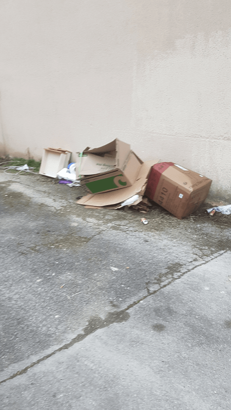
Les actes d'incivilités envahissent nos rues, agissons ! Un follow instagram = Un soutien
NOUVEAU : Décharges sauvages, détritus, objets abandonnés, graffitis, nids-de-poule : Déclarer un incident à Troyes

| Ville | Habitants | Superficie | Pop densité | Pop active | Taux chômage | Revenu moyen | Prix immobilier | Note globale |
|---|---|---|---|---|---|---|---|---|
| Statistiques Lavau | 971 | 5 km² | 194 h/km² | 45.8% | 4.2% | 24 670 €/an | 1 719 €/m² | - |
| Statistiques Pont-Sainte-Marie | 5 202 | 4 km² | 1 301 h/km² | 40.8% | 7.7% | 19 740 €/an | 1 658 €/m² | - |
| Statistiques Sainte-Savine | 10 457 | 7 km² | 1 494 h/km² | 46.5% | 7.2% | 21 590 €/an | 1 662 €/m² | 3.7 |
| Statistiques Saint-Parres-aux-Tertres | 3 214 | 11 km² | 292 h/km² | 40.8% | 4.9% | 23 550 €/an | 1 934 €/m² | 4.3 |
| Statistiques Saint-André-les-Vergers | 12 695 | 5 km² | 2 539 h/km² | 43.7% | 6.3% | 21 440 €/an | 1 540 €/m² | 3.7 |
| Statistiques Les Noës-près-Troyes | 3 260 | 0 km² | 3 260 h/km² | 39.7% | 7.7% | 18 750 €/an | 1 816 €/m² | 3.7 |
| Statistiques Rosières-près-Troyes | 4 866 | 6 km² | 811 h/km² | 43.8% | 4.3% | 24 100 €/an | 2 028 €/m² | 4.0 |
| Statistiques Saint-Julien-les-Villas | 6 752 | 5 km² | 1 350 h/km² | 44.1% | 6.8% | 22 370 €/an | 1 552 €/m² | 3.7 |
| Statistiques La Rivière-de-Corps | 3 681 | 7 km² | 526 h/km² | 42.7% | 3% | 25 040 €/an | 1 907 €/m² | 4.0 |
| Statistiques La Chapelle-Saint-Luc | 12 603 | 10 km² | 1 260 h/km² | 37.4% | 9.8% | 16 420 €/an | 1 487 €/m² | 3.4 |
| Statistiques Creney-près-Troyes | 1 996 | 15 km² | 133 h/km² | 41.2% | 2.8% | 25 060 €/an | 1 557 €/m² | 3.3 |
| Statistiques Barberey-Saint-Sulpice | 1 551 | 9 km² | 172 h/km² | 43.5% | 4.2% | 23 060 €/an | 1 907 €/m² | 3.4 |
| Statistiques Villechétif | 945 | 12 km² | 79 h/km² | 45.6% | 3.6% | 27 500 €/an | 1 798 €/m² | 1.8 |
| Statistiques Bréviandes | 3 091 | 6 km² | 515 h/km² | 45.8% | 5.4% | 23 440 €/an | 1 904 €/m² | 4.7 |
| Statistiques Sainte-Maure | 1 792 | 20 km² | 90 h/km² | 46.1% | 3.1% | 24 890 €/an | 1 806 €/m² | 4.2 |